The Pinellas Trail Through Dunedin: A Complete Guide
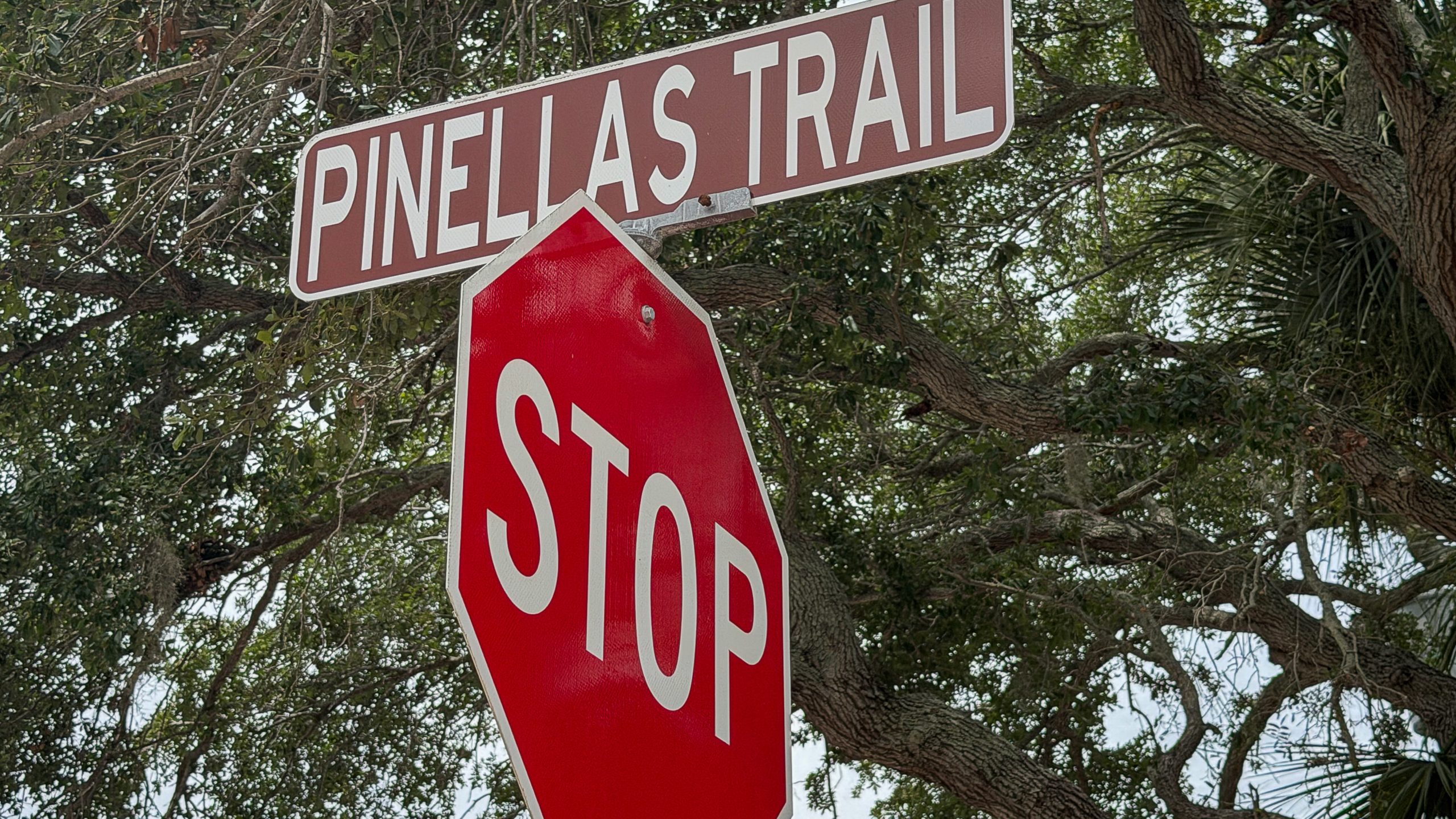
If you live in Dunedin or visit it regularly, the Pinellas Trail is something you cross or ride or walk almost without thinking about it. It runs through the middle of the city, north to south, the spine of how Dunedin moves on foot and on two wheels. Most of the people who use it daily probably do not know that they are riding on the bed of a narrow-gauge railroad that arrived in Florida in 1888, that the trail itself was a vision born from the grief of a father whose son was killed riding a bicycle, that the depot the museum sits in is the last surviving Orange Belt Railway station building, or that volunteers from a local Rotary club have been picking up trash and installing benches along this stretch of the trail for decades.
The trail rewards the attention. It is genuinely one of the most consequential pieces of public infrastructure in Pinellas County. The Fred Marquis Pinellas Trail runs 47 miles from Tarpon Springs to St. Petersburg and was inducted into the national Rail-Trail Hall of Fame in 2007. Estimates of annual usage run from just under a million users a year (the average since 1992) to over 1.5 million in more recent counts. By either figure, it is one of the most heavily used rail trails in America.
This piece is a complete guide to the section that runs through Dunedin. The history of the railroad that came first, the development of the trail itself, the businesses and parks and neighborhoods it passes, the civic stewardship that keeps it functioning, and the experience of actually walking or riding the trail from the northern boundary of the city to the southern. It is meant to be the definitive online resource for anyone who wants to understand this stretch of the Pinellas Trail at depth.
If you want broader treatment of the parks and natural areas around the trail, see Parks in Dunedin Florida Complete Guide and Dunedin Florida Parks Trails Waterfront. For the broader picture of the town the trail runs through, see the Ultimate Guide to Dunedin Florida and the History of Dunedin Florida.
A Railroad Before It Was a Trail
The Pinellas Trail exists because a railroad existed before it.
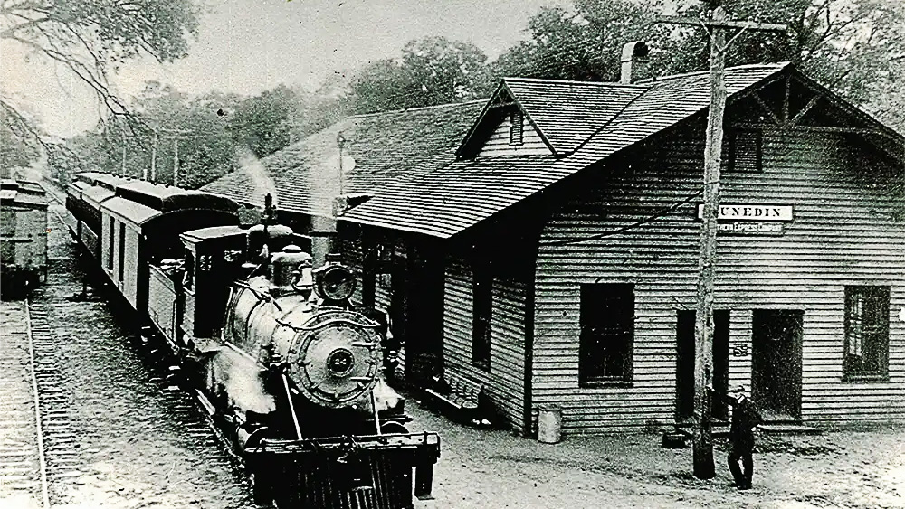
In 1885, a Russian exile named Peter Demens began building a narrow-gauge railroad that would eventually run 152 miles from Sanford to the Gulf of Mexico. He called it the Orange Belt Railway. On June 8, 1888, a small locomotive named Mattie pulled into a sandy bluff overlooking Tampa Bay with one passenger coach, one empty freight car, and one paying customer, a shoe salesman from Savannah who reportedly took one look at the desolate scrub and announced he was going right back home. The Orange Belt had arrived. The town at the end of the line was named St. Petersburg, after Demens’s home city in Russia, by Demens himself as part of the deal that allowed him to bring the railroad through.
The Orange Belt Railway ran through what would become Dunedin on its way from Sanford to St. Petersburg. The railroad transformed the Pinellas peninsula from an isolated stretch of scrub and pine into a working economy. Citrus growers used the line to ship oranges and grapefruit to northern markets. Passengers used it to come south for the winter or to settle. The settlement of Dunedin, which had been incorporated in 1899, depended on the railroad for both its economic life and its cultural life. The depot the Orange Belt built in Dunedin in 1888 is the only original Orange Belt station building still standing anywhere along the line, and it now houses the Dunedin History Museum, which I have written about at length in my piece on the Dunedin History Museum and Andrews Memorial Chapel.
The Orange Belt Railway itself did not last long under its original name. Financial troubles, a citrus freeze in 1894 and 1895, and the broader consolidation of American railroads pushed it through a series of owners. Demens lost the railroad to financier Edward Stotesbury, who reorganized it in 1893 as the Sanford and St. Petersburg Railroad. After the Great Freeze, Henry Plant bought the line as part of his expanding Florida system. The Orange Belt was absorbed into the Atlantic Coast Line, then into the Seaboard Coast Line through the 1967 merger, and finally into CSX during the modern era of American railroad consolidation.
By the 1980s, most of the original Pinellas trackage had been abandoned. The rails came up. The ties were hauled away. The roadbed sat empty across the peninsula, a 47-mile linear scar through eight municipalities. That is what Pinellas County inherited when the railroads were finished with the corridor.
How the Trail Got Built
The vision for what to do with the abandoned corridor came from a specific moment of grief.
In 1983, a Pinellas County resident whose son had been killed riding a bicycle began advocating for the abandoned railroad right-of-way to be converted into a safe space for cyclists and pedestrians. That advocacy turned into a serious policy conversation. The Florida Department of Transportation acquired the land in 1983. A Pinellas Bicycle Advisory Committee proposed using the right-of-way as a bike route in 1984. Pinellas Trails Inc., a nonprofit formed to promote public support for the linear park concept, came together in 1988. The Pinellas Board of County Commissioners approved the trail project in 1989, allocating $1.5 million to build the first 15-mile segment, with substantial additional funding through the Penny for Pinellas sales tax initiative designated for the next 35 miles.
Ground broke. The first six-mile section opened in 1990. The section from Taylor Park to Ozona, which passes through Dunedin, opened in 1992. Construction continued through the 1990s, with pedestrian overpasses built at the most dangerous road crossings to allow trail users to cross heavily used arteries safely. The West Bay Drive overpass in Largo was completed in 1990. The Park Boulevard overpass in Seminole opened in 1996. The full 47-mile trail effectively reached completion in the late 1990s, with continued improvements ever since.
The trail was named the Fred Marquis Pinellas Trail in honor of the longtime Pinellas County administrator whose support during the early years made the project possible. The full 47-mile, ADA-compliant, paved trail varies from 12 to 15 feet wide. Where space allows, a separate walking lane is marked off from the cycling lane to keep faster and slower users safe from each other. The trail crosses eight of the 24 municipalities in Pinellas County and connects to the regional and developing statewide trail networks.
The trail’s national recognition is real. The Fred Marquis Pinellas Trail was inducted into the Rail-Trail Hall of Fame in 2007. It is designated a National Recreation Trail by the U.S. Department of the Interior. It is part of the developing 75-mile Pinellas Trail Loop and is included in the Florida Coast-to-Coast Trail, a planned 250-mile route across the state from the Gulf of Mexico to the Atlantic Ocean. By any reasonable benchmark, the Pinellas Trail is one of the most successful rail-to-trail conversions in the United States, and Dunedin’s section runs right through the middle of it.
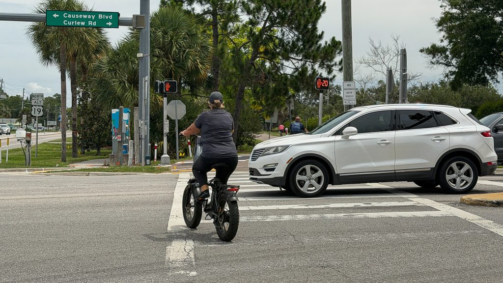
The Northern Gateway: Curlew Road and Alternate 19
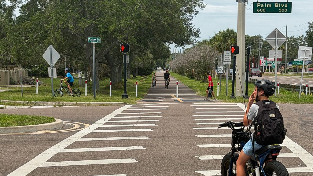
The northern entry into Dunedin’s section of the trail comes at the intersection of Curlew Road and Alternate U.S. 19. This is one of the most consequential and most challenging crossings on the entire Pinellas Trail.
Alternate U.S. 19, which through this stretch of the county is also called Bayshore Boulevard, is a major north-south arterial. Curlew Road is one of the primary east-west routes connecting inland Pinellas to the Gulf coast and the beaches. The intersection of the two is one of the busier signalized crossings in north Pinellas County, with vehicle counts running into the tens of thousands of cars per day across both roads.
For trail users, the crossing is at-grade rather than via an overpass. Pinellas Trail users coming south have to cross both Curlew and the trail’s grade-level intersection with Alt 19 within roughly a block. The crossings have signalized walk signs, and trail users have the right of way when their signal indicates. The honest reality on the ground is that motorists do not always honor those signals. Drivers turn right on red without looking for cyclists. Drivers run yellow-to-red transitions trying to make the light. Drivers do not always recognize that what looks like an empty bike trail can produce a cyclist moving across the intersection at speed.
For anyone walking or riding this section, the practical advice is unromantic and important. Make eye contact with drivers before you commit to crossing. Assume a driver turning right has not seen you. Stop fully at the signal even when your light is green and confirm that the motorists actually intend to honor the red they are facing. The right of way does not protect you from a driver who is not looking. This is the most dangerous single crossing on the Dunedin stretch of the trail, and it is worth the caution.
From the intersection, the trail enters Dunedin proper and begins its run south through the city.
The Northern Sections of the Trail Through Dunedin
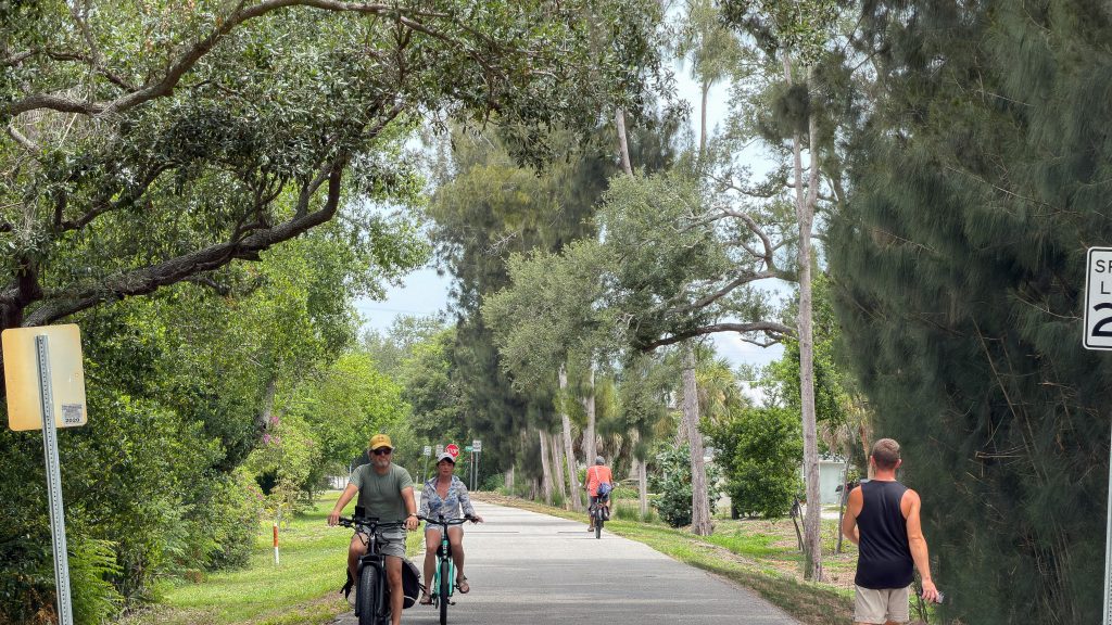
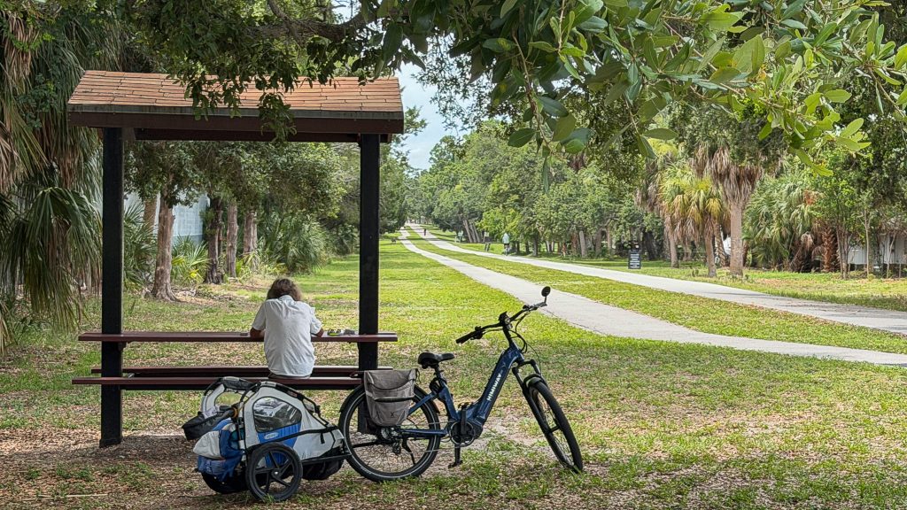
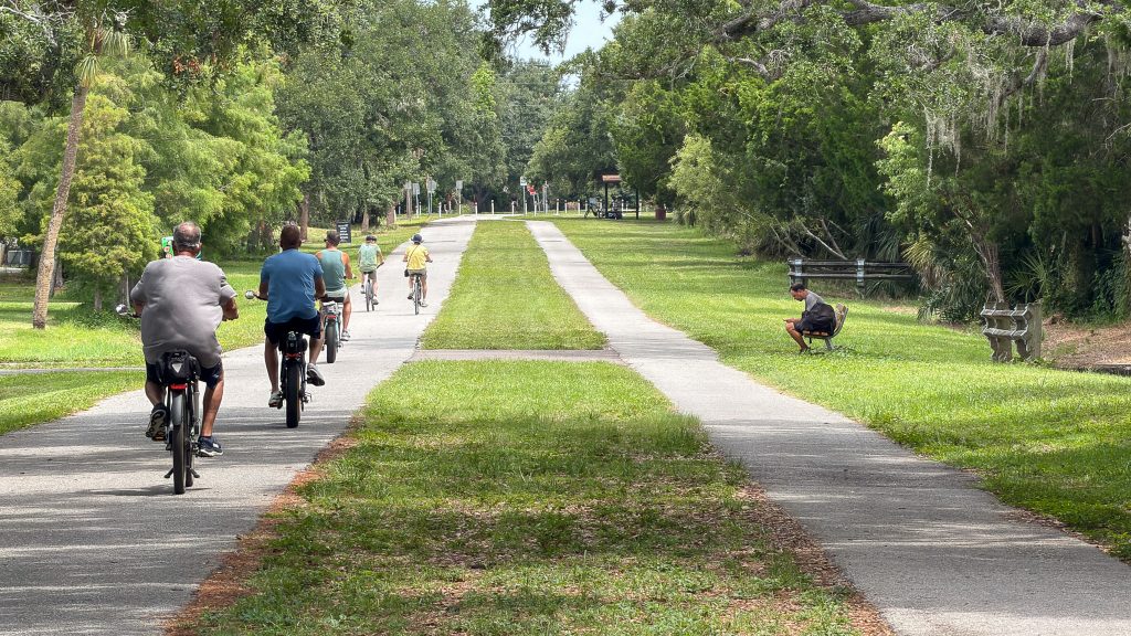
The northern part of Dunedin’s trail section runs through residential neighborhoods, with the trail flanked by mature trees, side streets, and a quieter feel than the busier downtown sections to the south.
This is where the slower, more reflective experience of the Pinellas Trail happens. Dog walkers in the morning. Joggers across the day. Families on bikes on weekends. Retirees moving at the pace they choose. The trail through this northern Dunedin section is shaded for substantial stretches, which matters in a Florida climate where direct summer sun makes the unshaded sections genuinely difficult to use during the hottest hours.
The Dunedin North Rotary Club has been part of the trail’s stewardship through this and adjacent sections for decades. Members of the club volunteer monthly to pick up trash along the stretch of the Pinellas Trail that runs through Dunedin, and the club has installed benches at various points along the trail to give walkers and cyclists places to rest and watch the world go by. That kind of sustained civic stewardship, month after month for years, is exactly the kind of unglamorous work that keeps a public space functioning. The trail looks clean and welcoming because people show up to keep it that way. The benches are there because people raised the money for them and chose where to put them.
I am a Realtor and a longtime Dunedin resident, but I am also a member of the Dunedin North Rotary Club, which is part of how I have come to know this work directly. The club has been doing it for a long time, and most users of the trail have no idea who is responsible for the bench they are resting on or the absence of trash they are not stepping over. That kind of invisible civic infrastructure deserves to be made visible occasionally.
Approaching Downtown Dunedin
As the trail moves south from the northern residential sections, it begins to approach downtown Dunedin, and the character of the experience shifts.
The transition is gradual rather than abrupt. The trees give way to more open sky. The side streets become more commercial. The number of pedestrians increases. The cyclists thin out somewhat as casual users join in for shorter downtown loops. The sounds of downtown begin to reach the trail well before the trail reaches downtown itself.
By the time you are within a few blocks of the downtown core, you are in one of the more genuinely walkable urban environments in Pinellas County. Dunedin’s downtown is compact and built around the trail in a way that very few American downtowns are. The trail is not adjacent to downtown. It runs through it. That orientation, which goes back to the original Orange Belt Railway alignment, means that the heart of the city has been organized around the rail corridor for more than 135 years.
The neighborhoods immediately adjacent to the trail through this approach are part of why Dunedin works as a residential market. They are walkable to downtown, walkable to the trail, walkable to the waterfront. Historic homes from the 1910s, 1920s, and 1930s line the streets feeding off the trail, and the architectural character of those homes is part of what gives the city its specific feel. For the deeper treatment of these historic homes, see my historichomestampabay.com Journal piece on the historic homes of Dunedin.
Downtown Dunedin
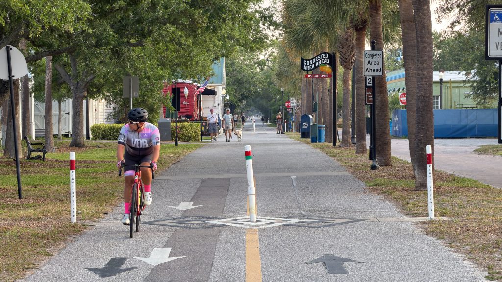
The section of the Pinellas Trail through downtown Dunedin is the heart of the experience and one of the most distinctive stretches of the entire 47-mile trail.
Downtown Dunedin is a small, walkable, Scottish-rooted Florida town that has built much of its commercial and civic life around the trail running through its core. The trail passes directly through the downtown commercial district, with restaurants, breweries, coffee shops, art galleries, and shops fronting onto it or sitting a block away. Trail users can pull off, lock up at a bike rack, and walk into any of dozens of small businesses.
The Dunedin History Museum sits directly on the trail in the old 1924 Atlantic Coast Line depot and houses the only surviving Orange Belt Railway station building. Pulling off the trail to walk through the museum is a way of physically experiencing the layered history of the corridor you have been riding. The trail and the museum are the same history. One paved for bikes, the other preserved as the original building. For the comprehensive treatment of the museum, see my piece on the Dunedin History Museum and Andrews Memorial Chapel.
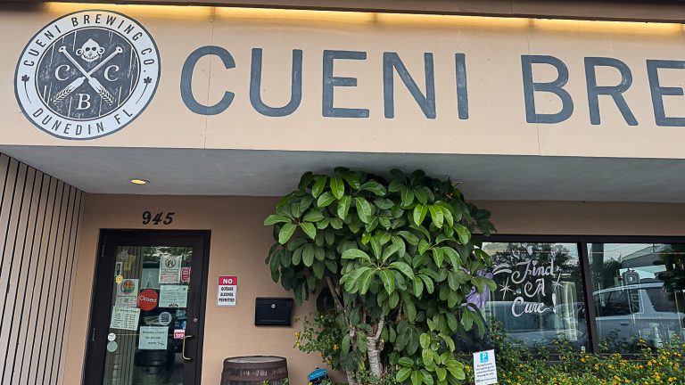
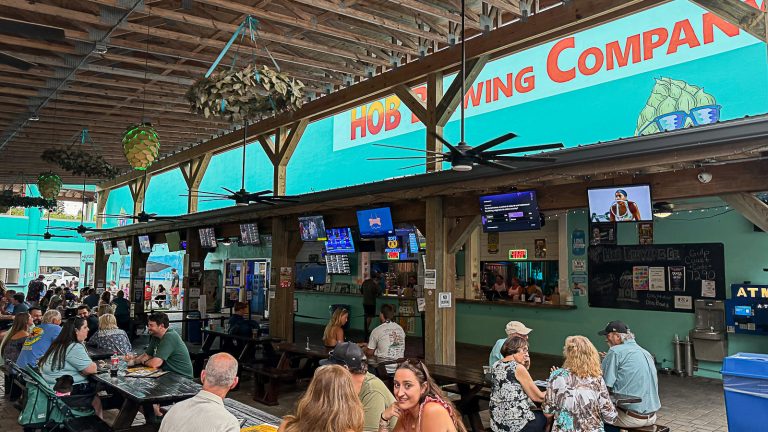
Along this stretch of the trail through downtown, several institutions and businesses are part of the daily life of the corridor. The Dunedin Brewery, the oldest microbrewery in Florida, sits a short walk from the trail. HOB Brewing Company and Cueni Brewing Company sit on the same block on Huntley Avenue, both built explicitly to serve the trail traffic that passes their patios and outdoor seating. I have written about both in this brewery trail series, the Cueni piece and the HOB piece. The pattern of brewery development concentrated on Huntley near the trail is not an accident. Walkable downtown with a trail running through it is exactly the setting craft breweries flourish in.
Coffee shops, restaurants, ice cream parlors, and small retail line the trail through the downtown core. The volume of foot and bicycle traffic that the trail brings into downtown Dunedin is genuinely substantial, and the local business ecosystem has organized itself around that traffic.
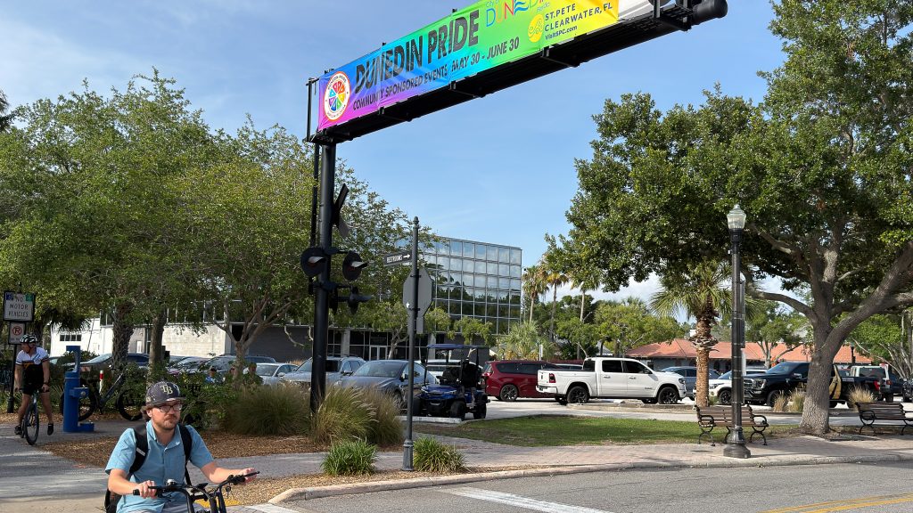
The trail also runs adjacent to several important pieces of public space through downtown. Pioneer Park, where the city’s signature events including the Dunedin Mardi Gras and Highland Games parades take place, is a short walk from the trail. The Dunedin waterfront and Marina are a short walk west of the trail through downtown. Edgewater Park and the public docks sit on the bay just off the trail. For the events that fill the downtown calendar around the trail, see A Year in Dunedin.
The Cultural Corridor
The trail through Dunedin also passes within walking distance of two of the most important cultural institutions in the city.
The Dunedin Fine Art Center, on Michigan Boulevard, is a short detour from the trail and houses a nearly 50,000-square-foot regional cultural institution with seven galleries, twenty working studios, more than 70 professional teaching artists, over 1,000 classes a year, and the David L. Mason Children’s Art Museum. I have written about the Fine Art Center at comprehensive length in the dedicated reference piece and in a more personal essay version on the role it plays in my own life as a hobbyist.
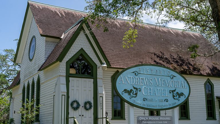
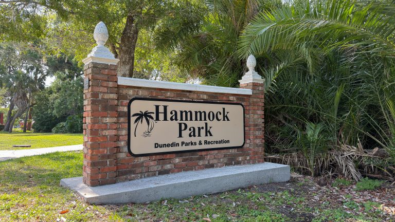
Andrews Memorial Chapel, the rescued 1888 chapel at the entrance to Hammock Park, sits west of the trail at 1899 San Mateo Drive. It hosts weddings, celebrations of life, concerts, and community gatherings and is one of the oldest surviving church buildings in the area. For the full story of the chapel and the founding rescue that brought the Dunedin Historical Society into existence, see the Andrews Memorial Chapel piece.
The cultural corridor along the trail, together with the trail itself, the museum on it, and the institutions reachable from it on foot or by bike, is exactly the kind of dense, walkable, culturally substantive fabric that distinguishes Dunedin from most American small cities. The trail is not a separate amenity in Dunedin. It is the connective tissue.
Southbound: From Downtown Toward Clearwater
South of downtown, the Pinellas Trail leaves the dense commercial core and runs through the southern residential neighborhoods of Dunedin.
The character shifts again. The mature oaks return. The pace slows. The trail passes through the southern Dunedin neighborhoods that have become some of the most coveted residential real estate in the city, with older Florida homes on tree-lined streets and the kind of walkable charm that has made Dunedin a destination for buyers who specifically want what the city offers. For the broader picture of what living in Dunedin involves, see Living in Dunedin Florida: The Complete 2026 Guide and Best Neighborhoods in Dunedin Florida.
The southern Dunedin trail section also passes near several parks and green spaces. For the comprehensive treatment of Dunedin’s parks system, see Parks in Dunedin Florida Complete Guide.
As the trail continues south, it approaches the boundary with the City of Clearwater. The southern boundary of Dunedin’s trail section is at Union Street. From there, the Pinellas Trail crosses into Clearwater, continuing south through that city on its way toward St. Petersburg.
Annual Usage and Economic Impact
The Pinellas Trail’s significance as a piece of public infrastructure is partly captured in the usage numbers.
The published figures vary across sources and across years. The average annual attendance on the trail since 1992 has been reported at 977,241 users, according to the National Recreation Trails database. More recent estimates from regional sources put current annual usage at over 1.5 million users a year, which would rank the trail as one of the most heavily used rail-trails in America. The earlier Pinellas County usage surveys found that more than 40 percent of trail users were commuting to work, school, parks, shopping, or restaurants, while exercise, recreation, and nature appreciation also ranked as major uses.
For Dunedin specifically, the trail is widely credited with assisting in the downtown redevelopment that turned the city’s commercial core from a quieter place into one of the most active small-town downtowns in Florida. The breweries, restaurants, coffee shops, and small businesses that line the trail through downtown are direct beneficiaries of trail traffic, and the City of Dunedin has organized substantial portions of its civic and tourism infrastructure around the trail’s presence.
The economic impact is real and measurable. Property values in neighborhoods within walking or biking distance of the trail consistently command premiums compared to comparable inventory further from the trail. Real estate listings throughout Dunedin reference trail proximity as a selling point. Tourism numbers tied to cycling tourism are significant. Restaurant and retail revenue tied to trail traffic is significant. The trail is not just a recreational amenity. It is a piece of economic infrastructure that has shaped how the city functions and grows.
Environmental and Sustainability Benefits
The conversion of an abandoned railroad corridor into a paved multi-use trail accomplishes several environmental and sustainability goals simultaneously.
The corridor preserves a linear green space that runs through one of the most densely populated urban counties in Florida. The trees and vegetation that line the trail provide shade, wildlife habitat, and stormwater absorption that would not exist if the corridor had been redeveloped as roads or commercial property. The trail itself supports non-motorized transportation, which means thousands of daily trips that would otherwise be car trips are happening on bicycles or on foot. Commuting on the trail is a real and substantial use, with the more than 40 percent commuter figure from the Pinellas County survey reflecting that.
The trail also supports a healthier population. The combination of walking, running, and cycling on the trail produces health benefits at a population scale that are difficult to capture in any single statistic but are real and substantial.
Connections to Other Trail Systems
The Pinellas Trail is increasingly part of a larger network of trails rather than a standalone amenity.
It is a foundational segment of the developing 75-mile Pinellas Trail Loop project, which will eventually create a full loop around the county. It is part of the Florida Coast-to-Coast Trail, a planned 250-mile route across the state from the Gulf of Mexico on the west to the Atlantic Ocean on the east. As these regional networks continue to develop, the role of the Pinellas Trail within them grows. A cyclist or walker can already use the trail as part of a much longer ride, and the future will expand those possibilities further.
For Dunedin specifically, the trail also connects practically to the Dunedin Causeway and Honeymoon Island State Park, two of the most distinctive natural and recreational areas in the region. I have written about the Causeway and Honeymoon Island elsewhere, including the post-storm changes that have transformed the north end of Honeymoon Island into what locals are now calling Oystercatcher Key.
The Future of the Trail
The Pinellas Trail is not finished, in any meaningful sense.
Pinellas County continues to invest in improvements. Pedestrian overpasses continue to be added where dangerous at-grade crossings warrant the investment. Signage and wayfinding are improved periodically. Connecting routes and spurs continue to develop. The integration with the Pinellas Trail Loop and the Coast-to-Coast Trail is an ongoing project rather than a completed one.
For Dunedin specifically, the future of the trail includes continued integration of trail-adjacent commercial development, continued improvement of the most dangerous crossings (including Curlew and Alt 19, which remains a candidate for an eventual overpass solution), and continued civic stewardship through volunteer organizations like the Dunedin North Rotary Club and Pinellas Trails Inc.
The trail will continue to compound in value over time, the way well-maintained public infrastructure does. The longer the trail exists and is used, the more it becomes a defining feature of the cities along it. Dunedin has been organized around this corridor since the 1888 arrival of the railroad. The trail is the modern continuation of a 138-year relationship between this town and this stretch of right-of-way. That relationship will keep developing.
Why It Matters
The Pinellas Trail through Dunedin is one of those pieces of infrastructure that has become so ordinary, for the people who use it daily, that its significance is easy to miss.
It was built because a father whose son was killed on a bicycle refused to let the death pass without changing the conditions that caused it. It exists because Pinellas County made the deliberate choice in 1983 to acquire an abandoned railroad corridor rather than letting it be sold off in pieces. It was funded by Penny for Pinellas sales tax dollars that voters approved. It was constructed across a decade of capital projects and continues to be maintained by ongoing public investment. It is stewarded daily by city staff, county workers, and volunteer organizations that include the Dunedin North Rotary Club picking up trash along this stretch every month and installing benches where people can rest.
What that adds up to is a 47-mile linear park running through the most populated county in Florida, used by more than a million people a year, accessible to every age and ability, ADA-compliant, mostly shaded, paved and maintained, and woven into the daily life of eight cities along its length. Dunedin’s stretch of that trail is one of the most distinctive and most heavily used sections, with the trail running directly through the historic downtown of a Scottish-rooted small Florida town that has organized itself around the corridor.
If you live in Dunedin and have never walked or ridden the entire trail through the city in one direction, that is worth doing once. From the northern gateway at Curlew Road and Alt 19 to the southern boundary at Union Street is a manageable distance for a casual ride or a longer walk. You will see the city differently afterward. The neighborhoods, the institutions, the businesses, the parks, the museum in the depot, the chapels and the Rotary benches, all of them line a single corridor that runs straight through the middle of Dunedin and has been the spine of the town for more than a century and a third.
The Pinellas Trail through Dunedin is the way to see the town the way the town was built to be seen.
About the author
I am Mark Middleton. I have lived in Dunedin since 2013, have walked and ridden the Pinellas Trail through Dunedin many times over those years, and am a member of the Dunedin North Rotary Club, which is part of how I know firsthand the monthly trash pickup and bench installation work the club has been doing along the trail for decades. I am also a Realtor with Compass, leading Middleton Tampa Bay, though my work on Discover Delightful Dunedin is about the town itself rather than about real estate. If you have stories or details about the Pinellas Trail through Dunedin that you think this piece should have included, I would welcome hearing about them.